3D Seismic Survey Data: Explore the Earth’s Subsurface
In the fields of geology, petroleum exploration, and natural resource management, 3D seismic survey data has emerged as a revolutionary tool for understanding the subsurface of the Earth. This advanced geophysical technique enables scientists and engineers to generate detailed three-dimensional images of geological structures beneath the Earth’s surface—something that was once only possible through expensive and risky drilling operations. Today, these datasets have become indispensable for companies exploring for oil and gas, as well as for governments and institutions involved in civil infrastructure and earthquake risk mitigation.
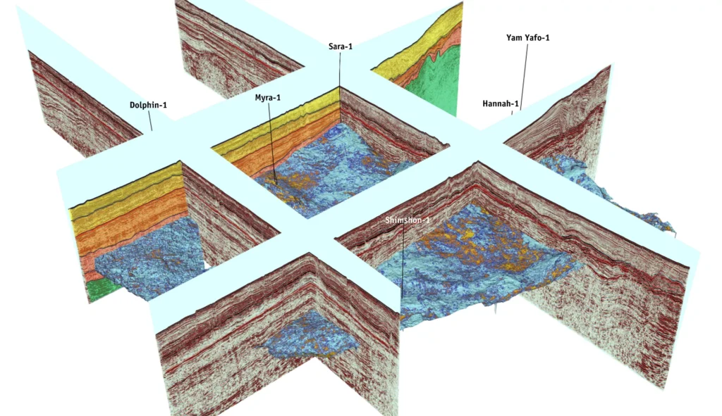
Historically, seismic exploration began with 2D surveys, which provided a cross-sectional view of the Earth’s layers along a single line. While useful, these surveys were limited in scope and often left significant ambiguities in data interpretation. With the introduction of 3D seismic surveys in the late 20th century, geoscientists gained the ability to visualize subsurface formations with far greater accuracy. By capturing data across a full grid of source and receiver points, 3D seismic allows for more comprehensive imaging of faults, folds, rock layers, and fluid reservoirs.
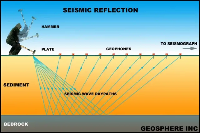
The core concept behind a seismic survey is straightforward: sound waves are generated at the surface using controlled sources (like vibrators on land or air guns at sea), and these waves travel downward into the Earth. As the waves encounter different rock layers, they are reflected back to the surface and captured by sensors known as geophones or hydrophones. The time it takes for the waves to return provides crucial information about the depth, density, and geometry of the rock layers. This raw data is then processed using complex mathematical algorithms and powerful computing systems to build a high-resolution 3D model of the subsurface.
One of the greatest advantages of 3D seismic survey data is its ability to pinpoint the location and size of potential hydrocarbon reservoirs before drilling begins. This significantly reduces exploration risks and improves the efficiency of resource extraction. In existing fields, 3D surveys are used to monitor the movement of fluids within reservoirs, identify bypassed pockets of oil, and optimize well placement. When performed over time, these surveys become 4D seismic studies, tracking changes within the subsurface across different production stages.
Beyond the oil and gas industry, 3D seismic data has found applications in urban planning, environmental monitoring, geothermal energy exploration, and even archaeological research. Engineers use these data to assess ground stability before building tunnels, dams, or high-rise structures. Environmental scientists rely on them to track groundwater movements or detect the risks of induced seismicity from human activities like wastewater injection or carbon storage.
As computing technologies advance, the resolution and processing speed of 3D seismic data continue to improve. Moreover, the integration of artificial intelligence and machine learning is transforming how geoscientists interpret complex datasets, allowing for faster, more accurate, and automated identification of subsurface features. This evolution is helping reduce human error, improve predictive models, and ultimately make geological exploration safer, smarter, and more sustainable.
With a growing global focus on energy security, sustainable resource use, and disaster preparedness, the role of 3D seismic surveys is more critical than ever. Whether it’s guiding multibillion-dollar offshore drilling campaigns or helping mitigate earthquake hazards in urban areas, this technology remains a cornerstone of modern geoscience.
How 3D Seismic Surveys Work
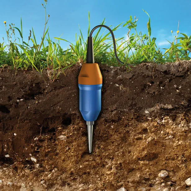
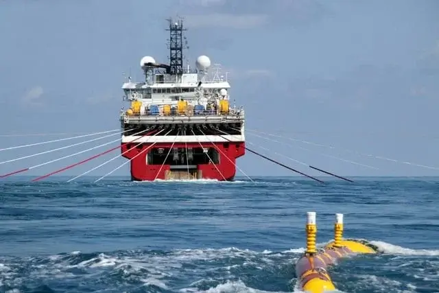
At the core of every 3D seismic survey is a carefully designed grid of seismic sources and sensors. In land environments, vibration trucks (vibroseis units) generate controlled seismic waves, while in offshore settings, air guns create energy pulses in the water. These waves penetrate the ground or seabed, reflect off different subsurface layers, and are recorded by an array of geophones or hydrophones spread across the survey area.
Data Collection and Processing
Once the seismic waves are recorded, they undergo extensive processing to create accurate 3D models. This involves filtering noise, correcting for time delays due to varying rock velocities, and enhancing signal clarity. Sophisticated algorithms such as Fast Fourier Transform (FFT), migration, and amplitude analysis are used to reconstruct a true three-dimensional image of the underground geology.

Applications in Oil and Gas Exploration
The oil and gas industry was one of the earliest and most enthusiastic adopters of 3D seismic technology. By allowing engineers to see detailed images of potential reservoirs before drilling, companies dramatically reduced the number of dry wells and improved recovery rates. This approach not only saves millions in exploration costs but also reduces environmental impacts by minimizing unnecessary drilling.
Reservoir Monitoring and 4D Seismic
Beyond initial discovery, 3D seismic surveys are essential in field development and production monitoring. Repeated surveys over time—referred to as 4D or time-lapse seismic—reveal changes in fluid distribution, pressure shifts, and production efficiency. These insights guide well placement, injection strategies, and reservoir management.
Urban and Civil Engineering Uses
In densely populated or earthquake-prone areas, 3D seismic data is a vital tool for civil engineers and city planners. It helps assess ground stability before constructing tunnels, metro systems, bridges, and skyscrapers. The detailed models generated from seismic surveys enable safer and more cost-effective infrastructure development.
Environmental and Geohazard Monitoring
3D seismic surveys are now widely used for environmental safety. They can detect potential ground shifts, monitor underground carbon storage sites, and ensure the integrity of wastewater injection zones. In regions with natural hazards, seismic imaging helps assess landslide risks or dormant fault lines, enabling early mitigation measures.
The Role of AI and Machine Learning
As the volume and complexity of seismic data grow, artificial intelligence has become an indispensable asset. AI-driven systems can now identify geological patterns, classify rock types, and even predict reservoir locations with high precision—reducing the time and human labor traditionally required in seismic interpretation.
Economic and Strategic Value
While conducting a 3D seismic survey can be expensive, the return on investment is considerable. Companies reduce exploration risk, increase discovery success rates, and gain deeper insights into their fields. For national energy programs, seismic data provides a strategic advantage in resource management and economic planning.
The Future of Subsurface Imaging
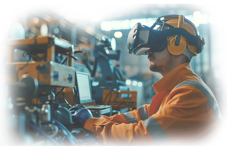
With the integration of real-time data collection, edge computing, and virtual reality, the future of seismic exploration is moving toward immersive and predictive modeling. Engineers may soon be able to “walk through” digital versions of reservoirs using VR headsets, making exploration and planning more interactive and insightful than ever before.
Summarizing the Power of 3D Seismic Data
3D seismic survey data has transformed the way we explore, analyze, and interact with the Earth’s subsurface. From oil and gas fields to civil engineering sites, this technology provides an unprecedented level of detail that supports informed, evidence-based decisions. The ability to visualize underground formations in three dimensions has saved industries billions of dollars, reduced environmental impact, and improved public safety in seismic regions.
Shaping Smarter Decisions
Perhaps the greatest contribution of 3D seismic surveys is their impact on decision-making. By turning invisible underground formations into visual, measurable models, engineers and scientists are able to minimize risk and improve operational planning. No longer reliant on guesswork, project leaders can now base drilling, construction, and resource management strategies on real, validated geological data.
Applications that Benefit Society
Beyond industrial use, 3D seismic data is proving valuable in societal applications. Government agencies and disaster management teams use it to map fault lines, assess earthquake risks, and prepare emergency response plans. It also plays a crucial role in environmental conservation, allowing for safe placement of critical infrastructure like dams, reservoirs, and underground storage sites.
Addressing Current Challenges
Despite its strengths, seismic surveying comes with challenges. High implementation costs, complex logistics in remote areas, and the need for advanced computing power can limit access to this technology. However, as processing becomes faster and more affordable, and as cloud-based tools become more widespread, 3D seismic data is expected to become more accessible across industries.
The Role of Research and Education
Academic institutions and geoscience research centers are vital to advancing 3D seismic technologies. Through simulation labs, field testing, and software innovation, researchers are refining data accuracy, reducing noise, and enhancing visualization. These efforts are also helping train the next generation of geoscientists who will take this technology to new heights.
Looking Ahead: Virtual Reality and Immersive Analysis
The integration of 3D seismic data with virtual and augmented reality is opening a new frontier. In the near future, geologists may explore virtual subsurface environments in real-time, gaining intuitive spatial awareness of complex formations. This immersive approach is set to revolutionize how we explore for resources and design infrastructure in harmony with nature.
Final Thoughts
In conclusion, 3D seismic survey data is far more than just a technological breakthrough—it is a strategic asset for modern industries and governments alike. Its accuracy, adaptability, and growing accessibility make it a cornerstone for safe development, energy security, and environmental responsibility. As innovation continues, seismic imaging will remain a key force shaping our understanding of the dynamic world beneath our feet.


